 vesseltracker.com
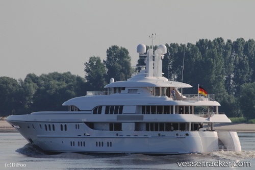
Vessel BELLA VITA IMO: 1010337, MMSI: 319032800 Houseboat
UTC, 43.32530, 5.35865, course: 148, speed: 0
UTC, 43.32527, 5.35860, course: 149, speed: 0
2026-02-04 02:11:39 UTC, 43.32525, 5.35865, course: 149, speed: 0
Live AIS position:
UTC. Near Marseille),
updated 2026-02-04 02:11:39 UTC.
Find the position of the vessel BELLA VITA on the map. The latter are known coordinates and path.
marine traffic ship tracker show on live map
The current position of vessel BELLA VITA is 43.32525 lat / 5.35865 lng. Updated: 2026-02-04 02:11:39 UTCCurrently sailing under the flag of Cayman Islands
BELLA VITA built in 2010 year
Deadweight:
189 tDetails:
Last coordinates of the vessel:
UTC, 43.32530, 5.35865, course: 149, speed: 0UTC, 43.32530, 5.35865, course: 148, speed: 0
UTC, 43.32527, 5.35860, course: 149, speed: 0
2026-02-04 02:11:39 UTC, 43.32525, 5.35865, course: 149, speed: 0